Irrigation is a major source of water for Sindh’s agricultural resources. While the actual irrigated area varies annually, subject to the availability of water, the total cultivated command area (CCA) in Sindh is equivalent to 5.1 million hectares and around 1.3 million hectares is classified as cultivable waste i.e. land which could be brought under cultivation if irrigation water were available. 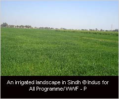
Irrigation water that is received from River Indus is channelized through the Sukkar, Kotri and Guddu Barrages irrigation systems. The irrigated areas of the province have been divided into five zones out of which three are major agro-ecological zones. These are as follows:
Zone-A: Rice/Wheat zone of the Right Bank of river Indus (upper Sindh).
- Sub-Zone A1 Main area
- Sub-Zone A2 Piedmont soil region
Zone-B: Cotton/Wheat zone of the left bank of River Indus.
- Sub-Zone B1 Guddu Barrage command area
- Sub-Zone B2 Sukkur Barrage command area
Zone-C: Rice/Wheat/Sugarcane zone of lower Sindh.
Besides the three agricultural zones, Zone D, comprises of deserts in the east of Sindh, and Zone E is the western hilly zone.
A major challenge faced by the irrigated areas is decreased flow of water from River Indus. Lack of irrigation water, forces people to extract groundwater where feasible to cultivate their lands exacerbating the problem of water logging and salinity. It has been estimated that due to flawed irrigation practices and lack of drainage facilities half of the cultivated area in Sindh has been affected by the menace of water logging and salinity, significantly reducing the crop yield and thereby negatively impacting the livelihood of people.
Source: Azad, A (2003) Sindh Water Resources Management: Issues and Options, FAO Investment Centre, Occasional Paper Series No.15.
| Chotiari Conservation and Information Centre Keenjhar Conservation and Information Centre Building Capacity on Climate Change Adaptation in Coastal Areas of Pakistan Take a SurveyWWF Tender Evaluation Report News Archives Upcoming Events Request for Proposals |
|
Friends of Indus 
Do not wait any longer; join hands in this noble cause by becoming a member of the Indus Forum More |
|